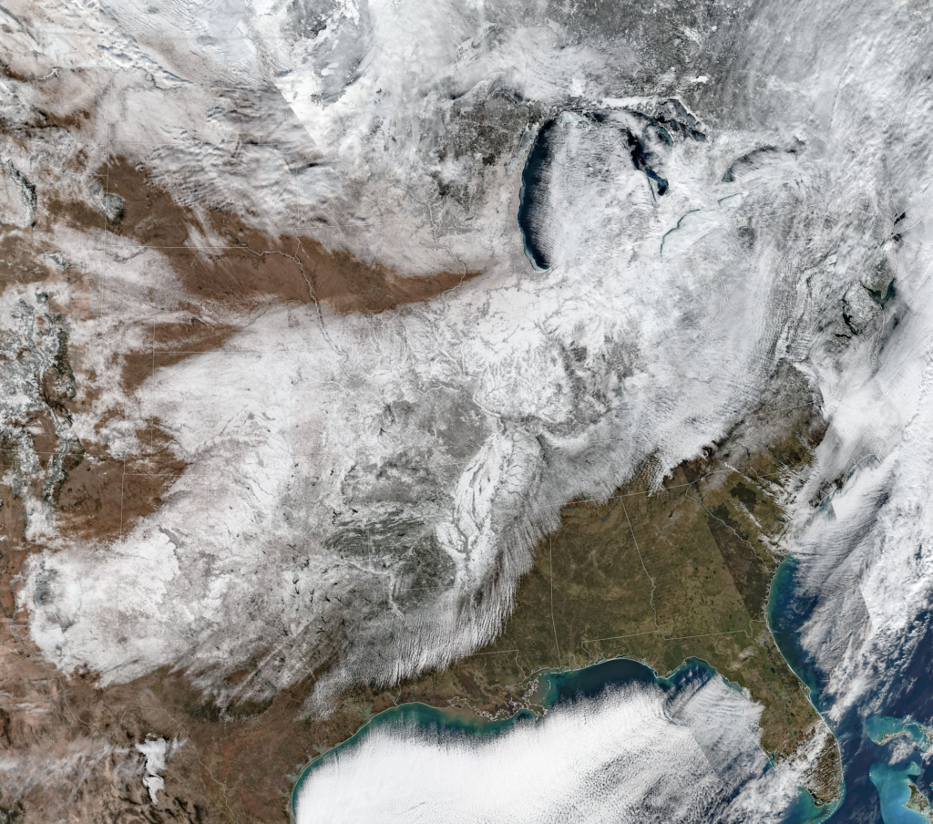
Jan. 26: As the clouds cleared after a storm, the scale of the white-out was visible from space.Satellite image by National Oceanic and Atmospheric Administration
For much of North America, the last month has been an icy, frozen trudge. But from the right vantage point, it had a certain beauty.
By Judson Jones and Leanne Abraham
Feb. 12, 2026, 5:30 a.m. ET
For much of North America, the last month has felt less like a season and more like a siege. From the ice-encased streets of Nashville to the frozen arteries of the Hudson River, an unrelenting Arctic pattern has locked the continent in a tundralike grip.
The year did not start this way. In early January, much of the East Coast was teased by above-average temperatures. But on Jan. 23, a huge discharge of Arctic air pushed through Canada and reached deep into the American South, flipping the script almost overnight.
It brought with it an enormous winter storm — a behemoth of historic proportions that etched itself into the lives of 200 million people as it crawled across two-thirds of the United States. It stretched from the southern Rocky Mountains to the coast of Maine, dropped either heavy snow or ice as it trudged east.
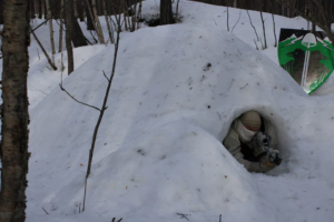
In Nashville, the whiplash was extreme. The start of January was its 12th warmest ever, in records that date from 1873; the second half quickly became its 13th coldest. The city straddled the storm’s transition zone between snow and ice. Nashville and areas nearby were glazed in up to an inch of ice that brought down power lines and turned thoroughfares into skating rinks. It took more than a week for many people around Tennessee to have their electricity restored.
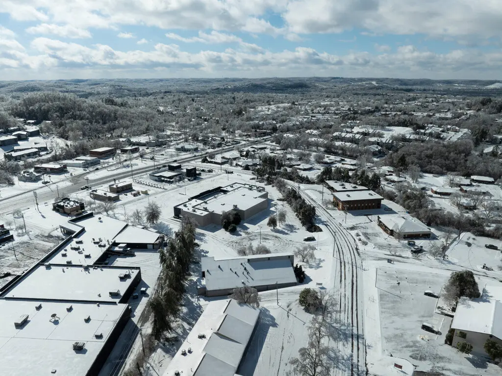
Jan. 26: Nashville was blanketed with snow after the winter storm.

Jan. 25: The storm covered interstates and highways in Louisville.
On Jan. 25, more than 18 inches of snow — 46.2 centimeters — fell at Toronto Pearson International Airport, breaking the record for daily snowfall at the airport, according to Eric Tomlinson of Environment and Climate Change Canada. Other areas around the city recorded two feet (60 centimeters) or more.
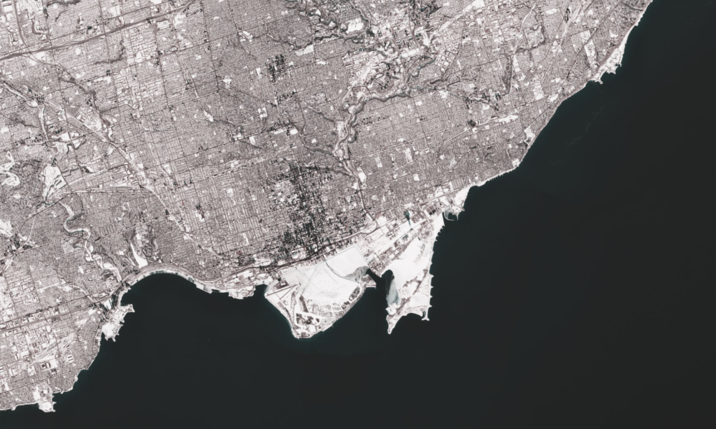
Feb. 4: Toronto, days after record-breaking snowfall.Satellite image by Copernicus
New York City faced its most sustained cold snap in decades. At Kennedy Airport, the temperature did not rise above 25 degrees for six straight days, tying a record. Temperatures in Central Park didn’t go above freezing for eight days. New York officials have reported that at least 25 people have died as a result of the prolonged cold snap.
Hudson River New York
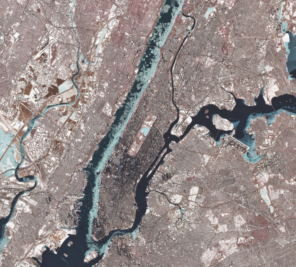
Feb. 8: The cold transformed the city’s geography. High-resolution satellite imagery revealed the Central Park reservoir and the Hudson River choked with ice.Satellite image by Copernicus. This image is a composite of infrared and visible-light data that highlights differences between ice (light blue) and open water, and snow and vegetation (red) from buildings and roads.
In the final days of January, this most wintry of winter months, the Carolinas faced a snowstorm of their own. For the first time in over a decade, measurable snow fell in each of North Carolina’s 100 counties; the brown sands of the Outer Banks were blanketed in white.
While the East Coast shivered, the Great Lakes also transformed. In a matter of days, the ice coverage on Lake Erie went from practically zero to nearly 90 percent, said James Kessler, an expert on Great Lakes ice at the National Oceanic and Atmospheric Administration.
On Feb. 8, a crack formed in the lake’s ice.
One of NOAA’s satellites caught the start of a small crack near Burwell, Canada, as it spread toward Cleveland. It soon became an 80-mile gap in the ice that Mr. Kessler called “the biggest one that I’ve seen.”
Start of ice crack Lake Erie
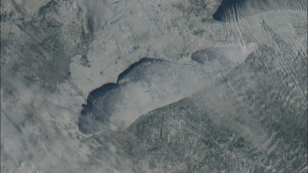
Feb. 8: A long crack in the ice spread on Lake Erie.Satellite image by the National Oceanic and Atmospheric Administration
But Lake Michigan has remained mostly unfrozen, especially around Green Bay, Wisc., which is sheltered and protected from the larger oscillations of the lake.
The freeze spared almost no part of the Eastern United States. Thousands of trees came down across the South. Florida had some of its coldest air in years, with readings dropping to 35 degrees in Miami. Snow was even reported in areas such as Tampa Bay, where temperatures fell below freezing.
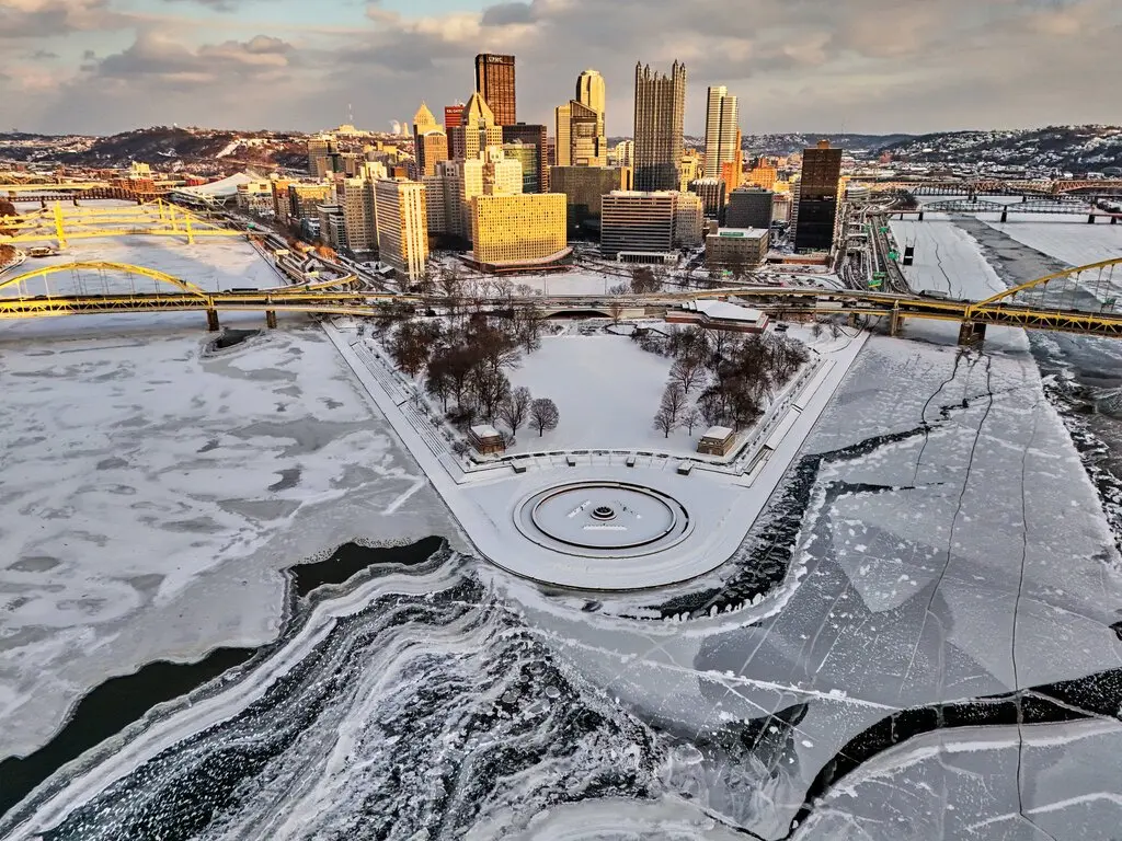
Jan. 28: The Allegheny and Monongahela Rivers in Pittsburgh partly froze.
As the cold blew over the relatively warmer water in the Gulf of Mexico, the air absorbed heat and moisture from below and formed long rows of parallel cumulus clouds aligned with the wind, which formed horizontal convective rolls — more commonly called cloud streets. The gap in clear sky near the coastline forms because cold air needs time and distance to pick up heat and moisture from the water to form clouds.
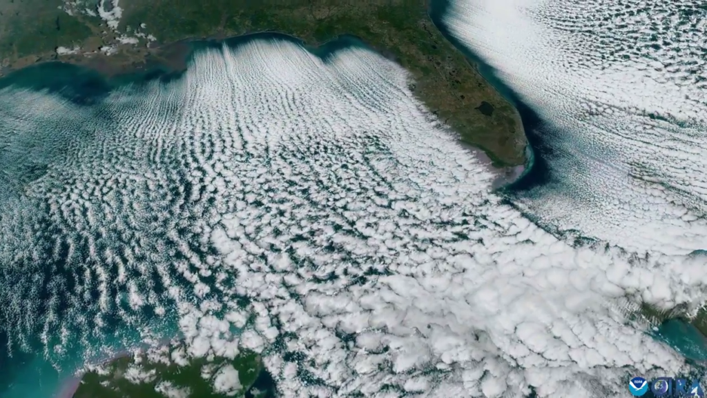
Feb. 1: Cloud streets, seen from space.Video by National Oceanic and Atmospheric Administration
Temperatures are rebounding to something closer to normal. Over the next two weeks, high temperatures are likely to remain above average everywhere east of the Rocky Mountains.
Original:https://www.nytimes.com/2026/02/12/weather/ice-great-lakes-satellite-winter.html